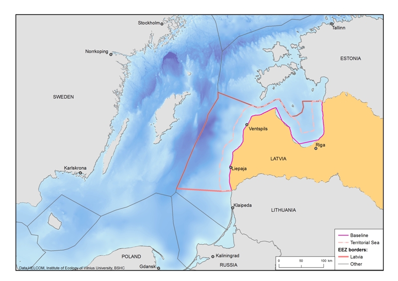
Maritime Spatial Plan (MSP) of Latvia is a national level long-term (up to 12 years) spatial development planning document that defines the use of the sea, considering a terrestrial part that is functionally interlinked with the sea and co-ordinating interests of various sectors and local governments in use of the sea. The MSP covers internal sea waters, territorial sea and exclusive economic zone.

Development of the plan was started in 2014 when a national MSP coordination group was established and initial enlightening seminar about national MSP for general public was organized. The first draft was prepared during 2015. National public consultations and cross-border consultations within the framework of Espo Convention were held in late 2015 and early 2016. In 2018 2nd version of the plan is elaborated and repeated national consultations and cross-border consultations within the framework of Espo Convention were carried out.
MSP was approved by the Government on 14.05.2019. Please see the overview of MSP in a summary here. Full MSP with annexes and Summary of Environmental report in english (unofficial translation) are available here:
- Final version of MSP of Latvia
- Annex 1 of MSP of Latvia
- Annex 2 of MSP of Latvia
- Annex 3 of MSP of Latvia
- Summary of Environment report
Ministry was involved in 2 MSP related projects Baltic SCOPE and Baltic LINes: Coherent Linear Infrastructures in Baltic Maritime Spatial Plans. Both projects helped with MSP stakeholder engagement in Latvia and internationally.

On 1 October 2024, the Cabinet of Ministers approved the Interim Assessment to evaluate implementation of Latvian MSP. The projects like MSP-GREEN, SELINA and Baltic Sea2Land has also served as a support to the Interim Assessment and will be useful for updating the MSP.
For more information please contact:
Kristīne Kedo, kristine.kedo@varam.gov.lv, +371 67026558
The Ministry of Smart Administration and Regional Development of the Republic of Latvia
Spatial Planning and Land Management Department
Head of Spatial Planning Policy Unit